

2024 was a frustrating year in that the works to replace the floodgates prevented us from accessing the full length of the path, and also prevented access to the Worsall Road path (which was originally closed following damage to the boardwalks). Once the floodgate work was complete we were able to start project planning for the remainder of 2025/26 with our principal attention being directed towards a re-commencement of the Worsall Road remedial work including the construction of new boardwalks.
We have compiled 2 phased reports detailing our work throughout 2024 to 2026
Our normal maintenance activities include :
1 Planting plans for the True Lovers Walk path
2 Bank stabilisation measures
3 Invasive Species control (especially Himalayan Balsam)
4 Re-commencement of remedial, re-building and repair work on the
Worsall Road path
5 New member induction and Training
6 Current Members’ Training programme
7 Fundraising
So what are we currently undertaking?
2024 and beyond


Visitors to TLW regularly ask us what is happening with the Worsall Road pathway which was closed during Covid due to structural damage to footbridges and boardwalks, together with the complete erosion of the path in some places.
So here follows two updates (Phases 1 and 2) for the work that the Friends of True Lovers’ Walk group have been conducting to reinstate the footpath which leads south from the Scholars Court river entrance on West Street, Yarm to an exit on Worsall Road.
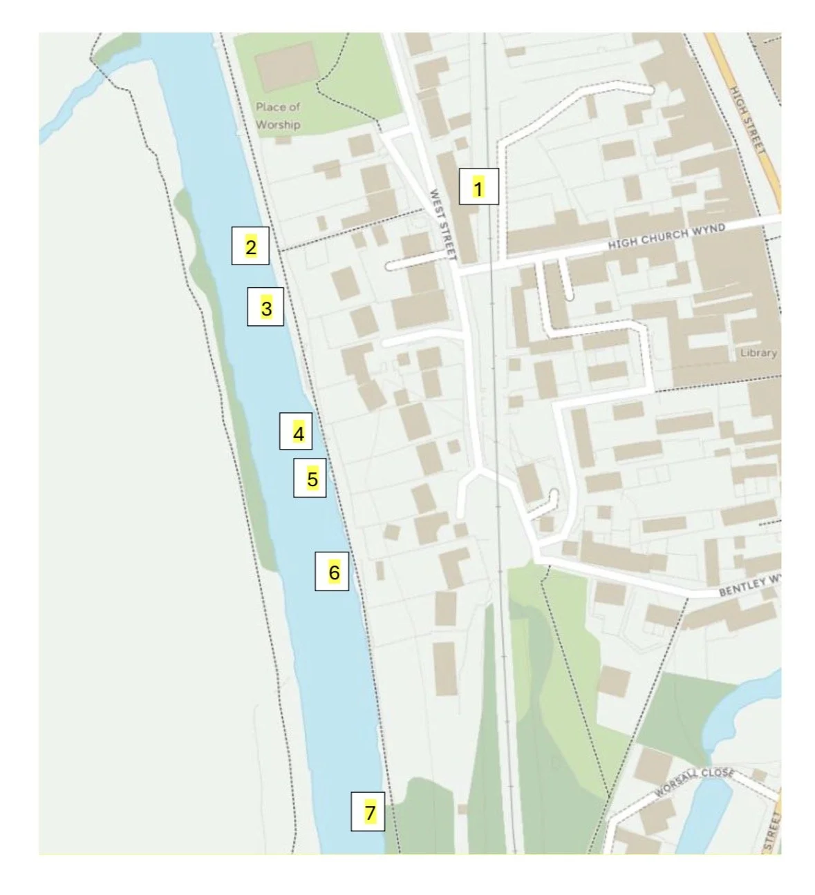
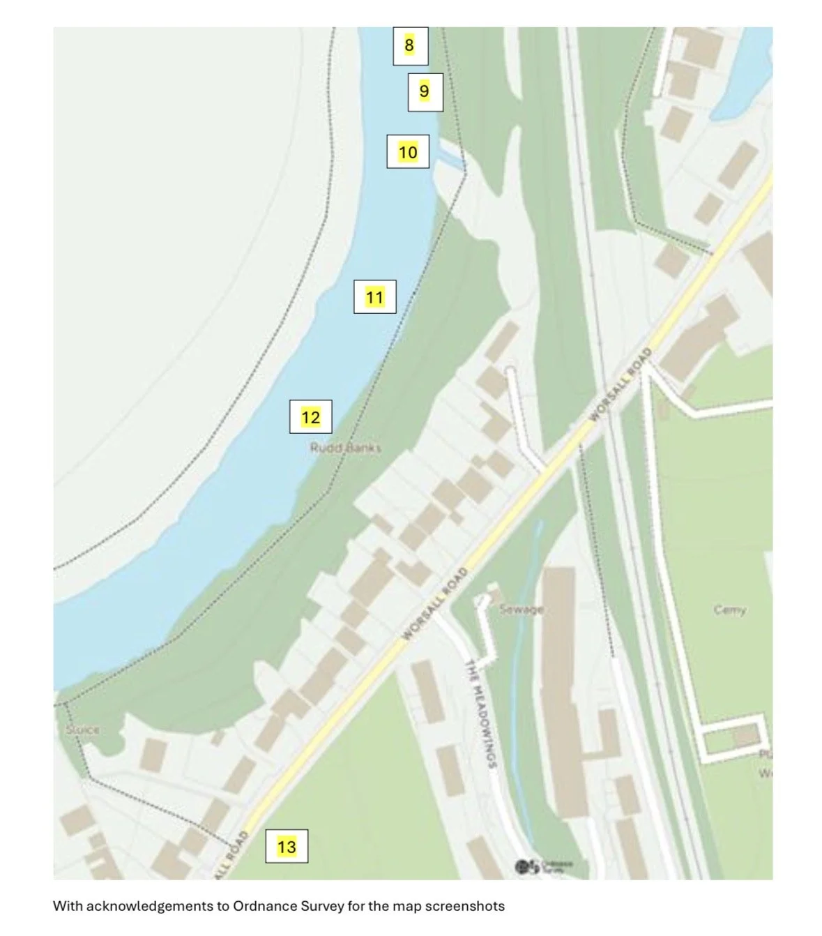
Please note, we refer periodically throughout this update to “points” which are detailed within
Appendix 1 (Maps and References) including a Map Key to help explain location sites.
We secured a Lottery fund grant to work on reinstating this path and we have used this so far for the purchase of tools and materials. All our labour has been on a voluntary, unpaid, basis.
During 2024 we conducted some preliminary work on scoping the project and obtaining advice from the Groundworks Charity and from Stockton Borough Council. We also did some vegetation clearance and minor path improvement working from the direction of the Worsall Road entrance. The project was put on hold for a time due to the difficulties in accessing the path whilst BAM Nuttall were installing the new Yarm floodgates, together with an instruction from the Environment Agency that we were not to attempt to clear Himalayan Balsam whilst it was in seed.
We recommenced work on the project in April 2025 when the floodgates were completed and we could obtain access to the path from the Scholars Court entrance ( 1 and 2 on the maps below).
Initial Path Clearance
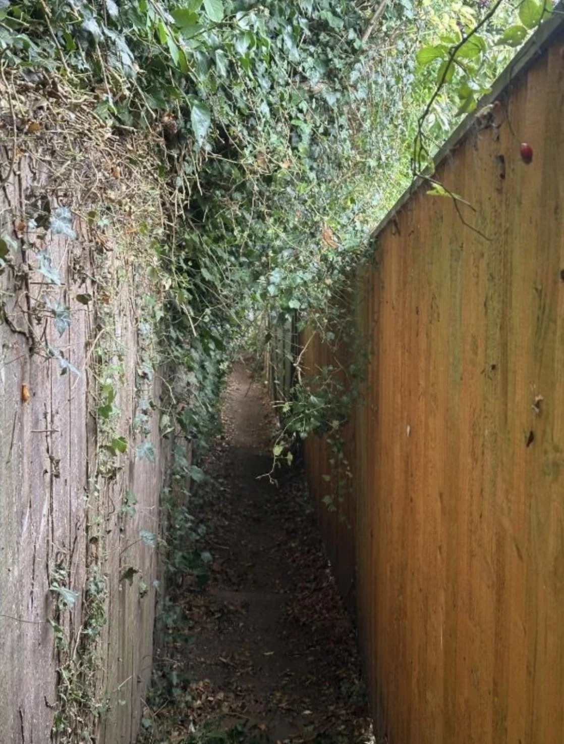
The first section of the path from points 2 to 4 was densely overgrown and our first task was to uncover the existing path by strimming and overgrowth clearance. At point 3 the landowners prefer that we do not remove any overgrowth other than that along the 1.5m public footpath – additional clearance means the riverside can be too easily accessed by anglers, who have previously abused this area by littering or camping there. After several discussions with the landowners at 23, 25 and 27 West Street, we agreed to this request, and we have adhered to it in our operations.


TLW: Worsall Road Path Reinstatement
Phase 1 Update - October 2025
At and beyond Point 7 there were several fallen trees which we cleared with a chainsaw.

Bridge and Boardwalk Challenges
Our first construction challenge at points 4 and 5 on the map was to replace the existing damaged bridgework and boardwalks


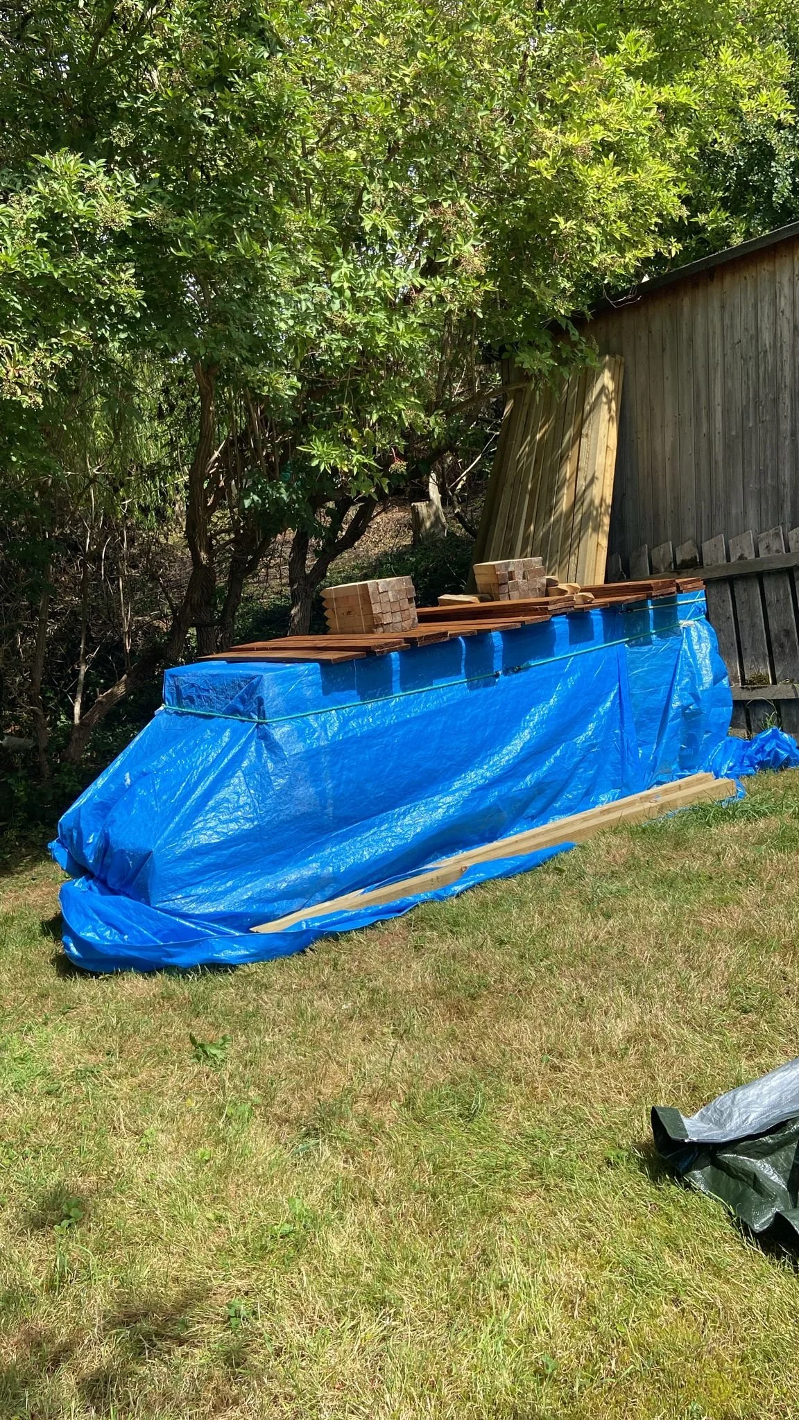
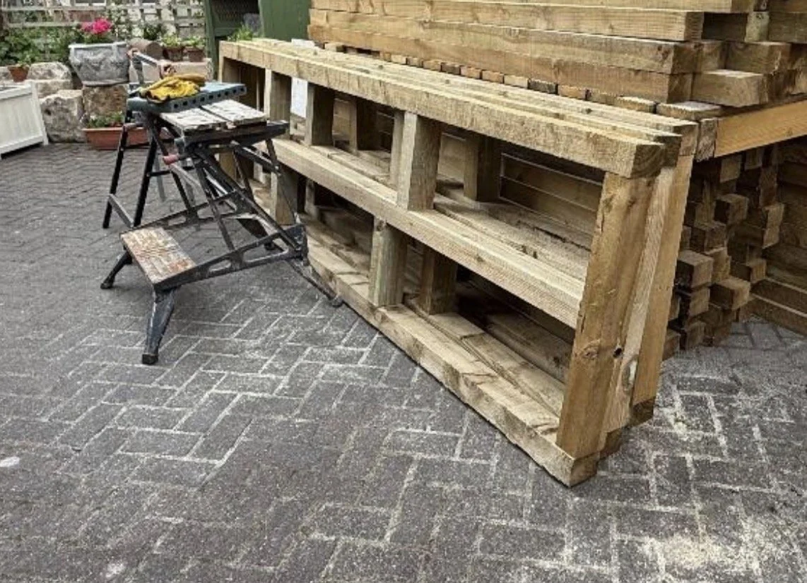
To do this, we worked during May and June 2025 to construct robust wooden frames which served as the bases of the new boardwalks. We had all the timber delivered to a member’s house in Bridge Street and constructed the first nine frames in his yard.


The frames were heavy and awkward to move, and our next challenge was to get them to the location they were needed on the riverbank. As the house of one of our members was close to the bridgework, we moved the frames to there and, on Sunday 13th July 2025, we managed to move five of them to the riverbank down the steep slope, using dollies and ropes to lower them carefully and let gravity do the work.


Path Stabilisation Measures
We needed to carry these frames along the riverbank to the location they were needed. In parts, the riverside path was dangerous in this area and certainly could not safely be used to carry heavy loads. So, over a few sessions we improved the path by levelling it and installing boards to stabilise it


Path Clearance
Whilst some of the group worked on these measures, other members of the team used the time to carry out other path clearance as far as the Skytering Beck outfall, point 10 on the map. This included chopping through dense vegetation at point 7 and removing as much Himalayan Balsam as possible.
Phase 1: Bridge and Boardwalk Installation
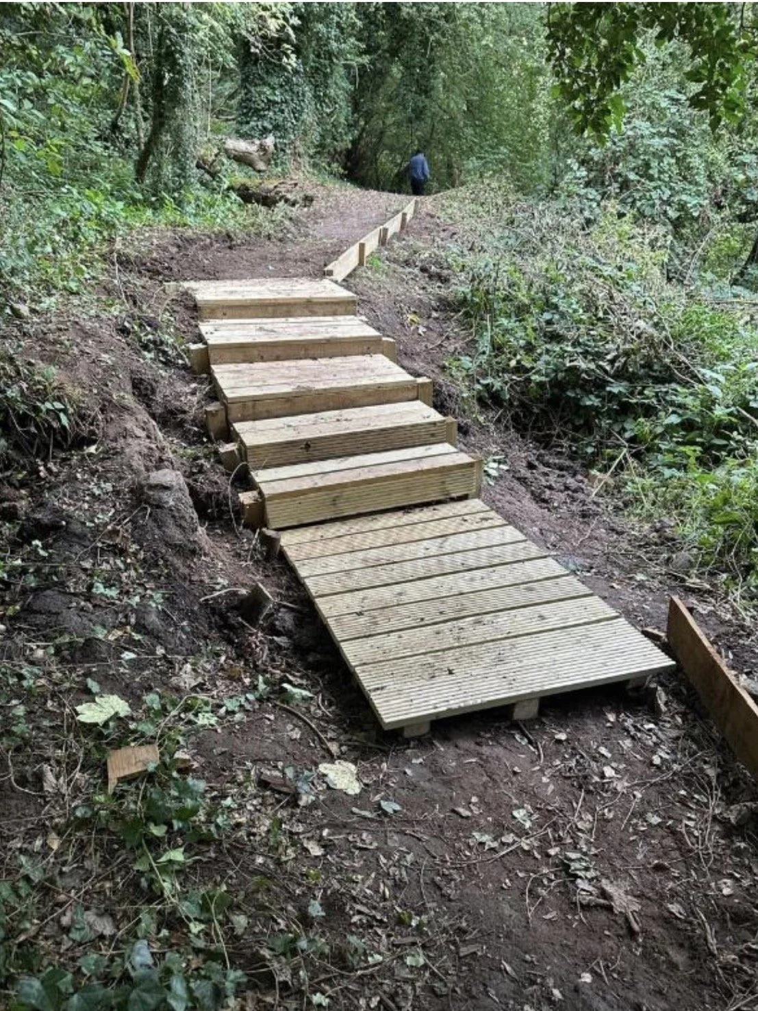
With the access path safe to work on, we were able to commence installing the first section (approx.20m) of elevated boardwalk.
We completed the finishing touches to this first section in mid-September 2025.

Moving north, along from this long section of boardwalk, there was a nasty step where the path had fallen into the river and we installed a short, 5m, bridging section over this to improve safety and access.

And this then gave us safer access for volunteers and materials to the 9m section of collapsed bridging which we replaced using 3 x 3m frames.


We finished all these sections by late September 2025, with significant efforts made by the volunteers to complete them before any change in the weather.
Looking forwards - preparing our Phase 2 Planning
With the onset of Autumn 2025, the pace of our work lessened slightly. The first flood of the season, with water levels raised at Yarm and most low-lying paths submerged, occurred on 21st September 2025 and some of our structures were submerged for the first time, fortunately with no damage.
We therefore used the time to plan for phase 2 and remedial works to the path beyond Skytering Beck outfall.
We also continued path stabilisation where needed, working south along the river and particularly around point 9 where an existing wire fence had fallen, partially obstructing the inclined path.
Looking ahead, we recognised we would have some significant challenges at points 11 and 12, where the river erosion had caused landslips which obliterated the path. In those areas, we would need both path diversions and stabilisation measures, and we would need to liaise with the landowner and the SBC highways/footpaths manager to achieve a solution.
In some places we will need to construct additional boardwalks and stairs.
Videos
For some video reports on the various sections, see the following Google Drive links :
Phase 1 Completion Walk Through end September 2025
https://drive.google.com/file/d/1eOzNZCVGPBiWe9TkznIMWIbcOEwycj0M/view?usp=d rive_link
Walk through from Skytering Beck Outfall to proposed path diversion
https://drive.google.com/file/d/107zEl3Pwd1NaHrQ5- nUskVJQl5JQHuk5/view?usp=drive_link
Walk through from Worsall Road entrance to proposed path diversion
https://drive.google.com/file/d/1dOdA0- 2k1ccI7jhjmOlxoQ8vvWtbMJOF/view?usp=drive_link
Appendix 1 - Map and References


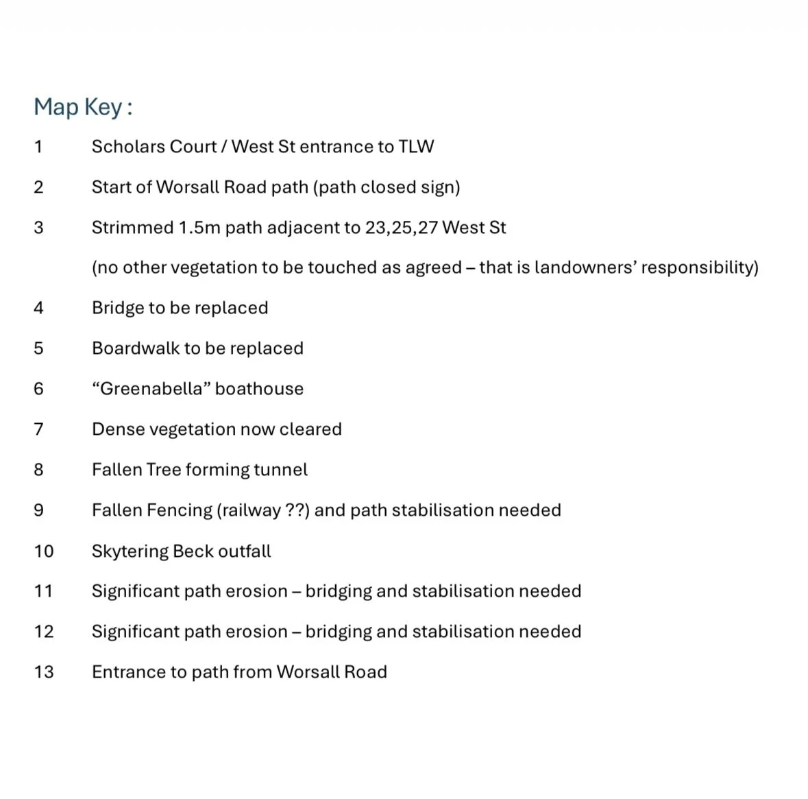
Map Key:
(With acknowledgements to Ordnance Survey for the map screenshots)
Scholars Court / West St entrance to TLW
Start of Worsall Road path (path closed sign)
Strimmed 1.5m path adjacent to 23,25,27 West St
(no other vegetation to be touched as agreed – that is landowners’ responsibility)Bridge to be replaced
Boardwalk to be replaced
Carole’s boathouse
Dense vegetation now cleared
Fallen Tree forming tunnel
Fallen Fencing (railway ??) and path stabilisation needed
Skytering Beck outfall
Significant path erosion – diversion and stabilisation needed
Significant path erosion – diversion and stabilisation needed
Entrance to path from Worsall Road
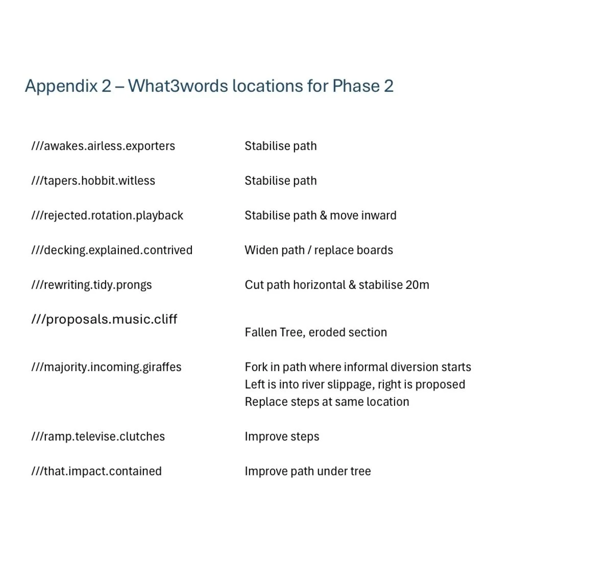
Appendix 2 - What3words Locations for Phase 2
//awakes.airless.exporters Stabilise Path
///tapers.hobbit.witless Stabilise Path
///rejected.rotation.playback Stabilise Path & move inward
///describes.outright.shopping Dangerous area, needs diversion and safety work, approx 5m (see map below)
///decking.explained.contrived Widen path/replace boards
///rewriting.tidy.prongs Cut path horizontal & stabilise 20m
///swoop.hang.narrates Really bad section/big divert around (see map below)
///fittingly.backs.successes Bad step, build steps or otherwise as diversion (see map below for location of reroute)
///majority.incoming.giraffes Fork in path where informal diversion starts. Left is into river slippage, right is proposed.
Replace steps at same location
///ramp.televise.clutches Improve steps
///that.impact.contained Improve path under tree
///hence.removed.swear Rope Assist consider
///inspected.bake.toffee Steps or rope needed
Map Extracts for Worst Locations

TLW/Worsall Road Path Reinstatement
Phase 2 Update October 2026
Following our Phase 1 efforts which were covered in our report October 2025, we can now report on our Phase 2 work during the remainder of the 2026 season to October.
Map references with numbered highlights refer to map locations in the Appendix at the end of this Update with added What3words locations where available.
Techniques and approaches
Our first construction challenge last year at points 4 and 5 on the map was to replace the existing damaged bridgework and boardwalks.
To do this, we constructed robust wooden frames which served as the bases of the new boardwalks. We had all the timber delivered to the home of one of volunteers on Bridge Street (the late Mr Anthony Aherne) and constructed the first nine frames in his yard.
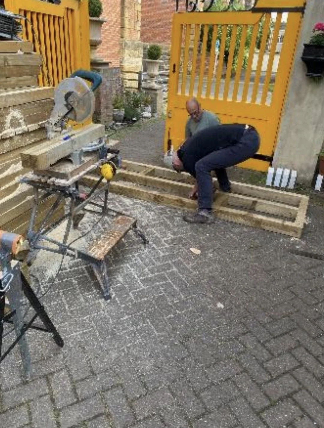
The frames were heavy and awkward to move, and getting them to the location they were needed on the riverbank was difficult.
This year we have cut the timber to size at the West Street garage location, moved individual timbers to the “Greenabella” boathouse, and from there to our work location, erecting the frames in situ when they are required.
This is still a labour intensive process as the distance from the boathouse to the main work area at 11 and 12 is approximately 400 metres over uneven ground.
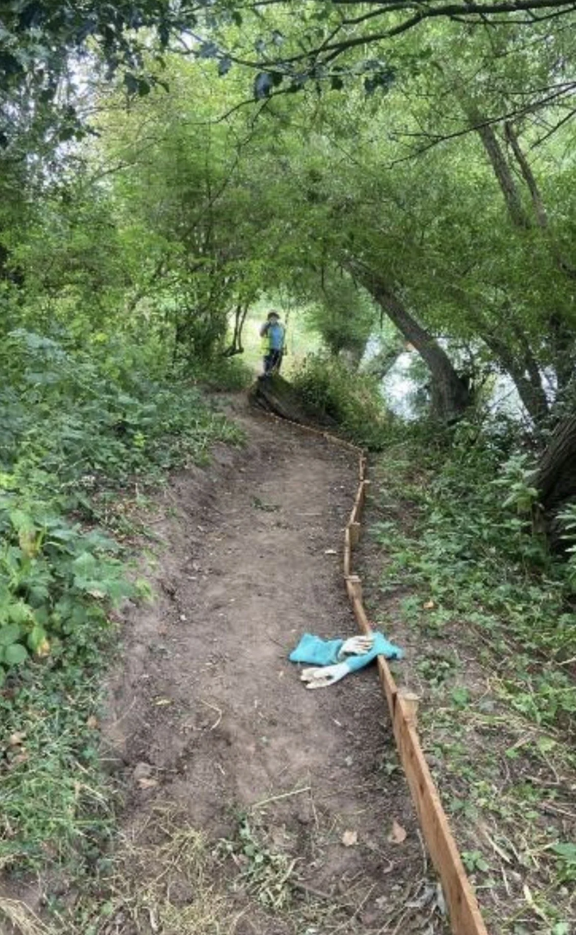
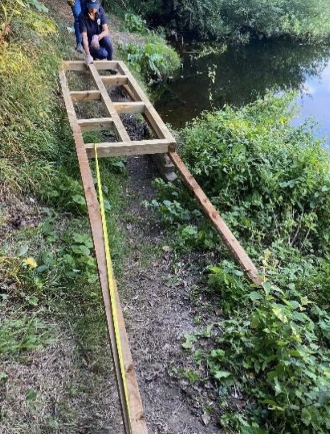
Before
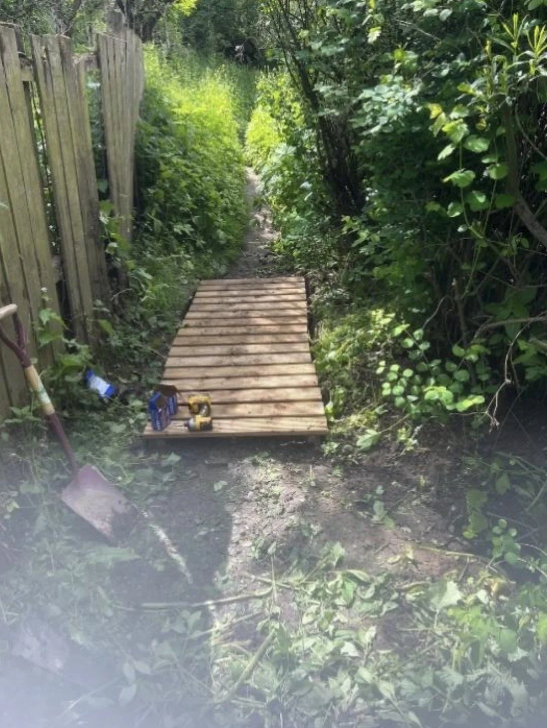
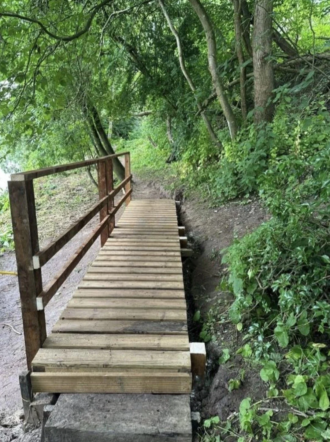
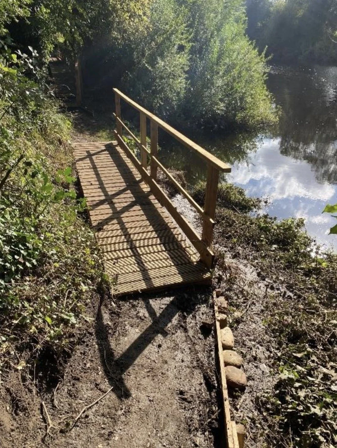
Rudds Bank Bridge 1, completed June 2026
Map reference 11
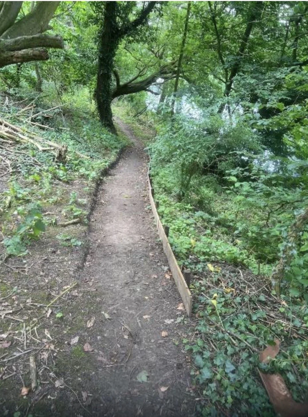
Path stabilisation leading up to Rudds Bank Bridges
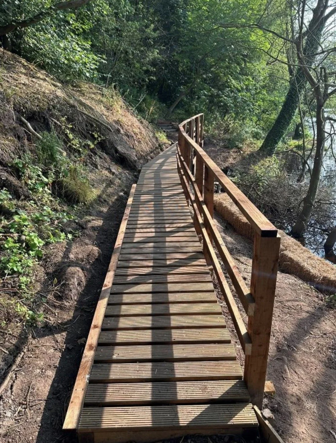
Rudds Bank Bridge 2, completed July 2026
Map reference 12
Since July we have focussed on path improvements between this bridge and the end of the path at the Worsall Road entrance.
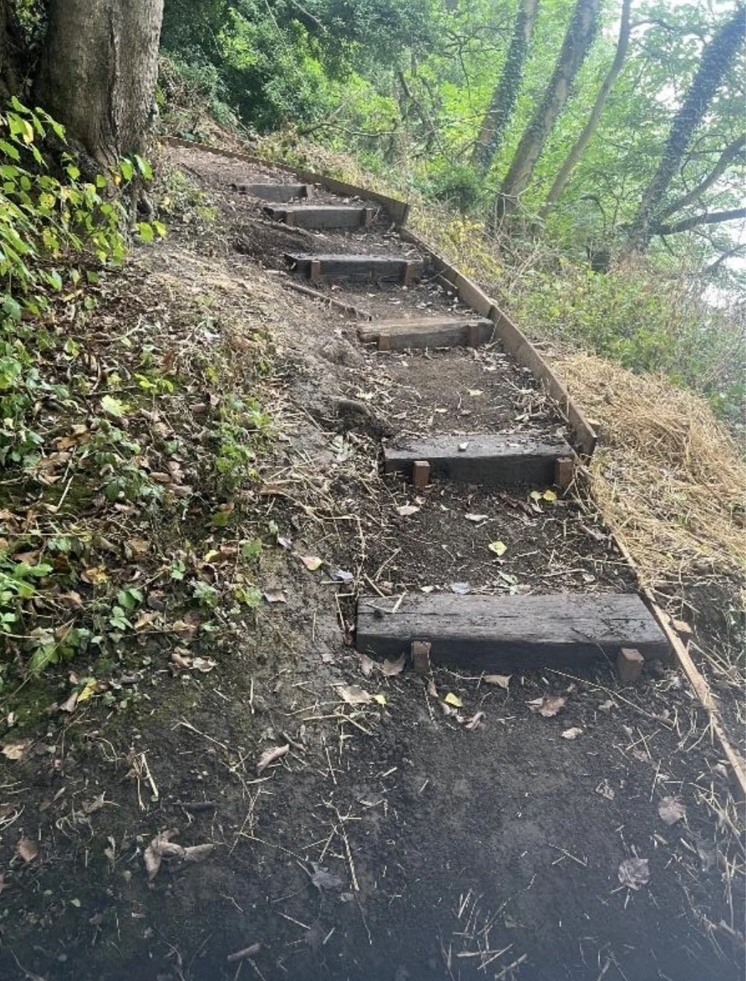
Path Stabilisation and safety measures
Where necessary, and to improve our safe access to the work site, we have carried out path stabilisation by levelling the pathway and boarding edges.
We have continued to control Giant Hogweed where it is impinging on the path or our work area.
We had a meeting with Tees Rivers Trust on 12th May to discuss their plans for invasive species control along this stretch, and they carried out some spraying work the same day.
After
Frames are built onto posts sunk approx. 900mm deep and stabilised with Postcrete. Posts are cross-braced for extra strength.
Our main challenge this year was in the area marked 11 and 12 where a significant landslip and fallen tree were the main obstacles.
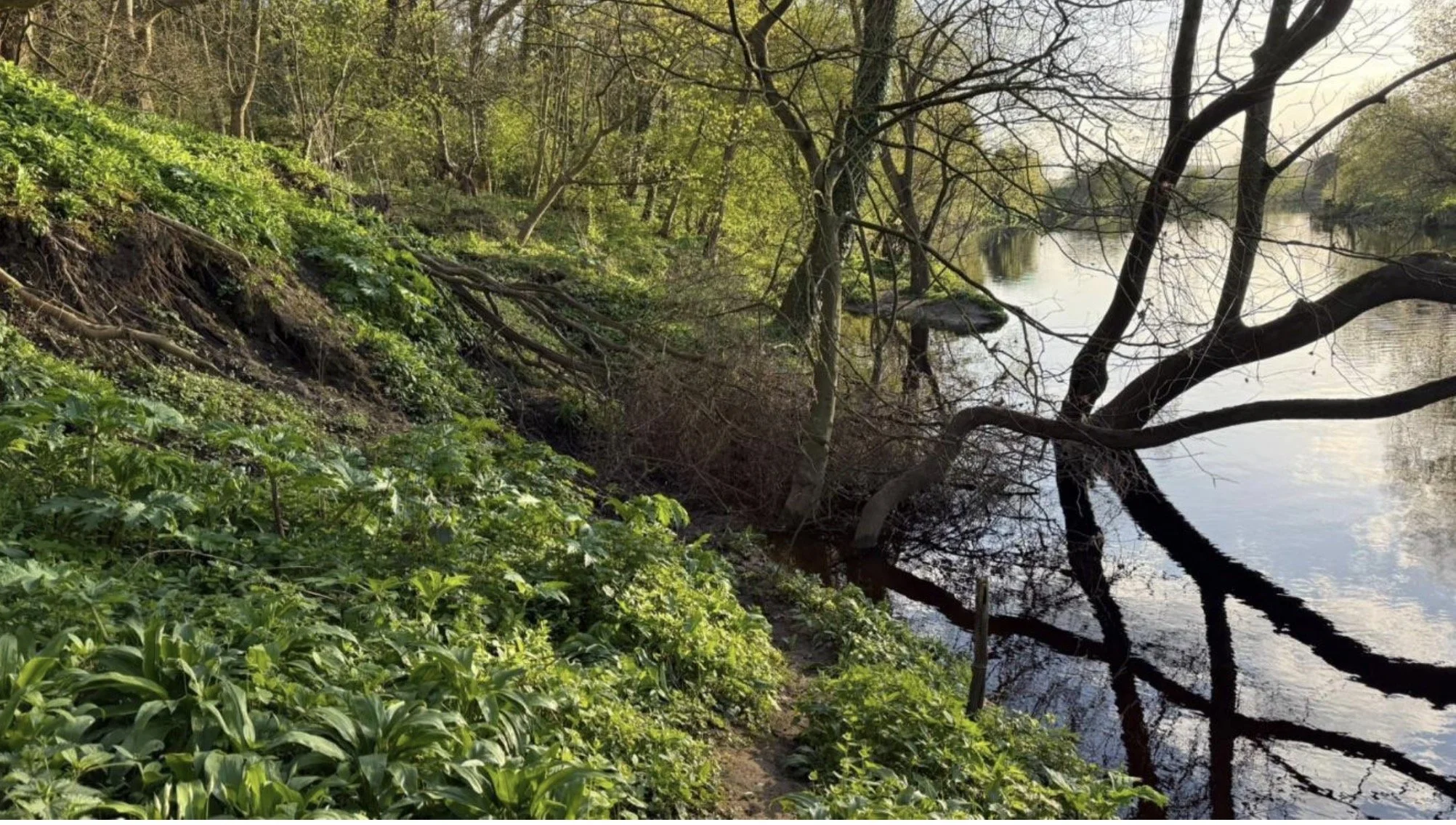
Location:///proposals.music.cliff
As the whole of the woodland is subject to a Tree Preservation Order, we obtained permission from Mark Nozedar, Principal Tree & Woodlands Officer at SBC, to remove the dead tree and we did this on June 16th.
We carried out path improvement and stabilisation leading up to this section to enable safe access to the site with tools and materials.
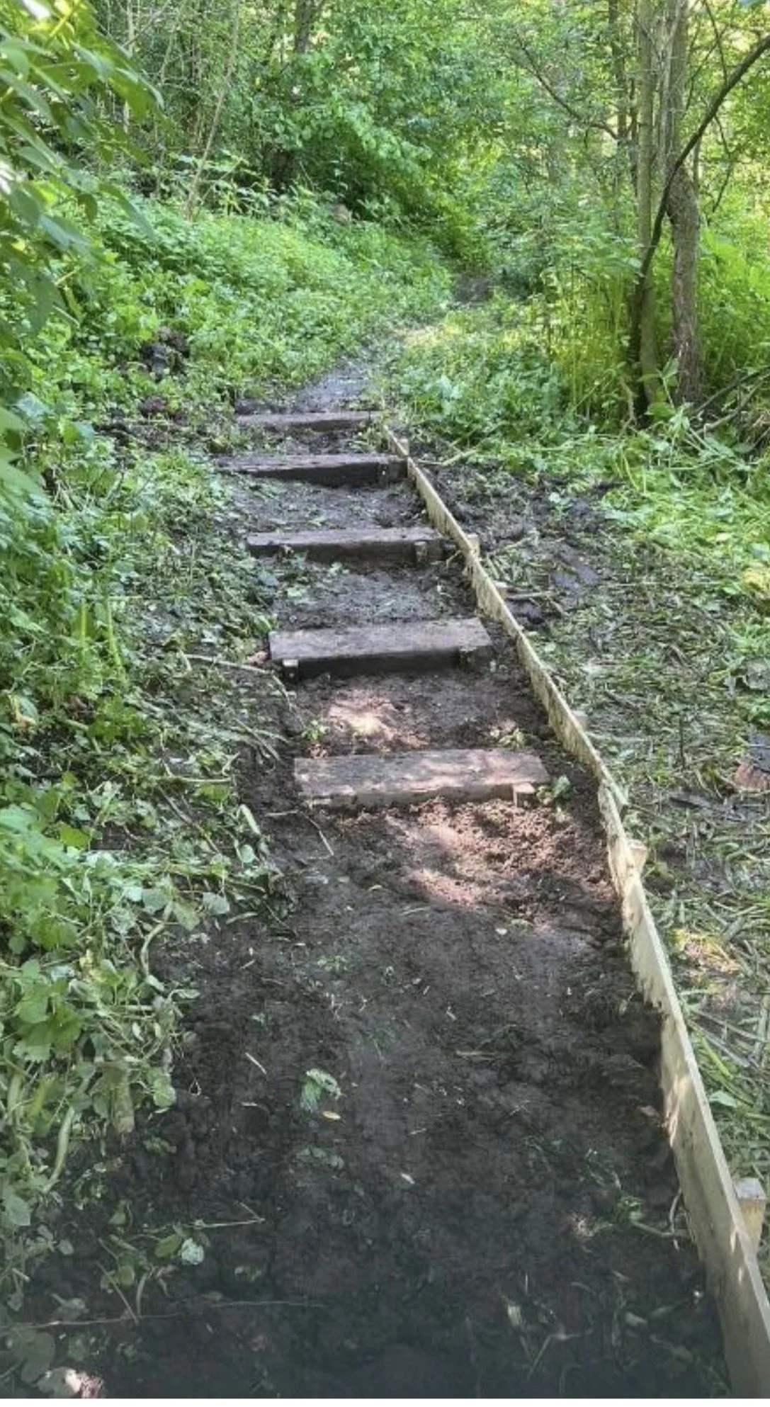
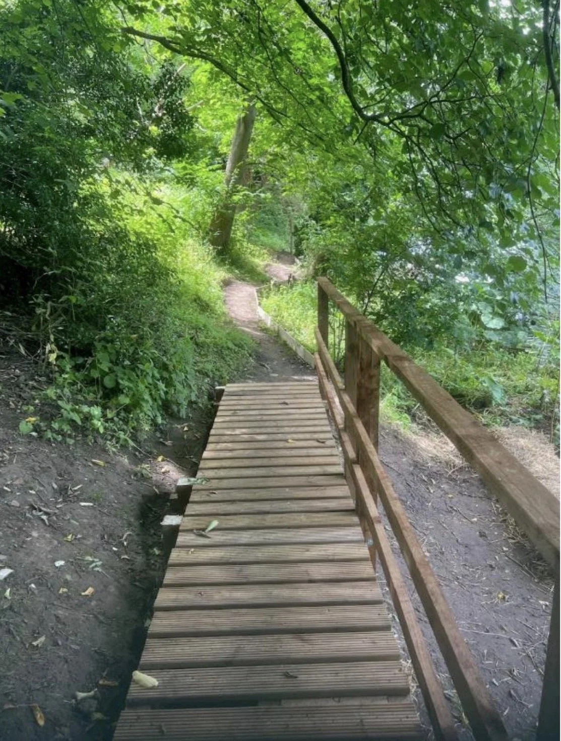
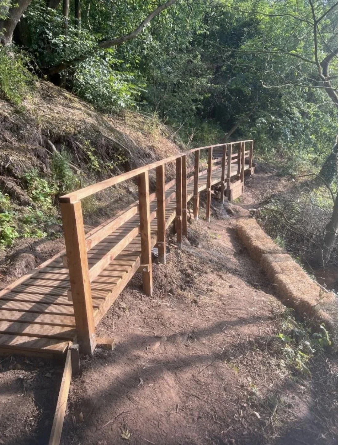
Path improvement beyond Rudds Bank Bridge 1
Overgrown bush and shrubbery clearance at Worsall Road entrance
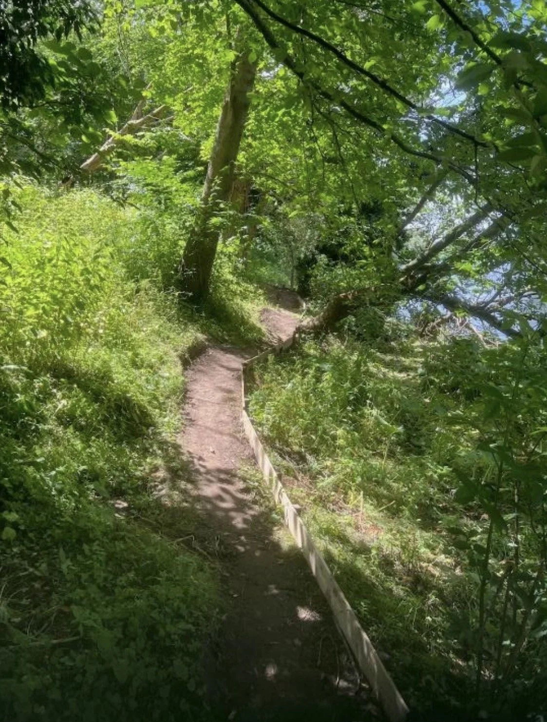
Once we had cleared the tree fall, we were able to progress with bridging the land slip section, which we commenced this on June 21st.
This was the toughest part of our work this year and required many hours of effort to complete the finished bridge , which we did by end of July.
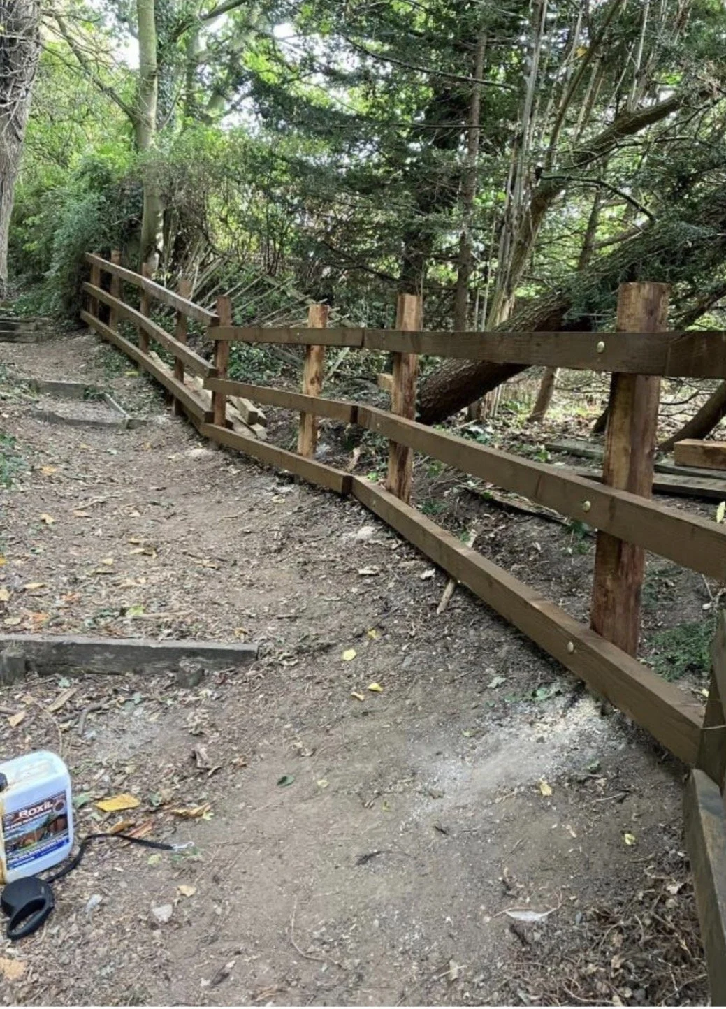
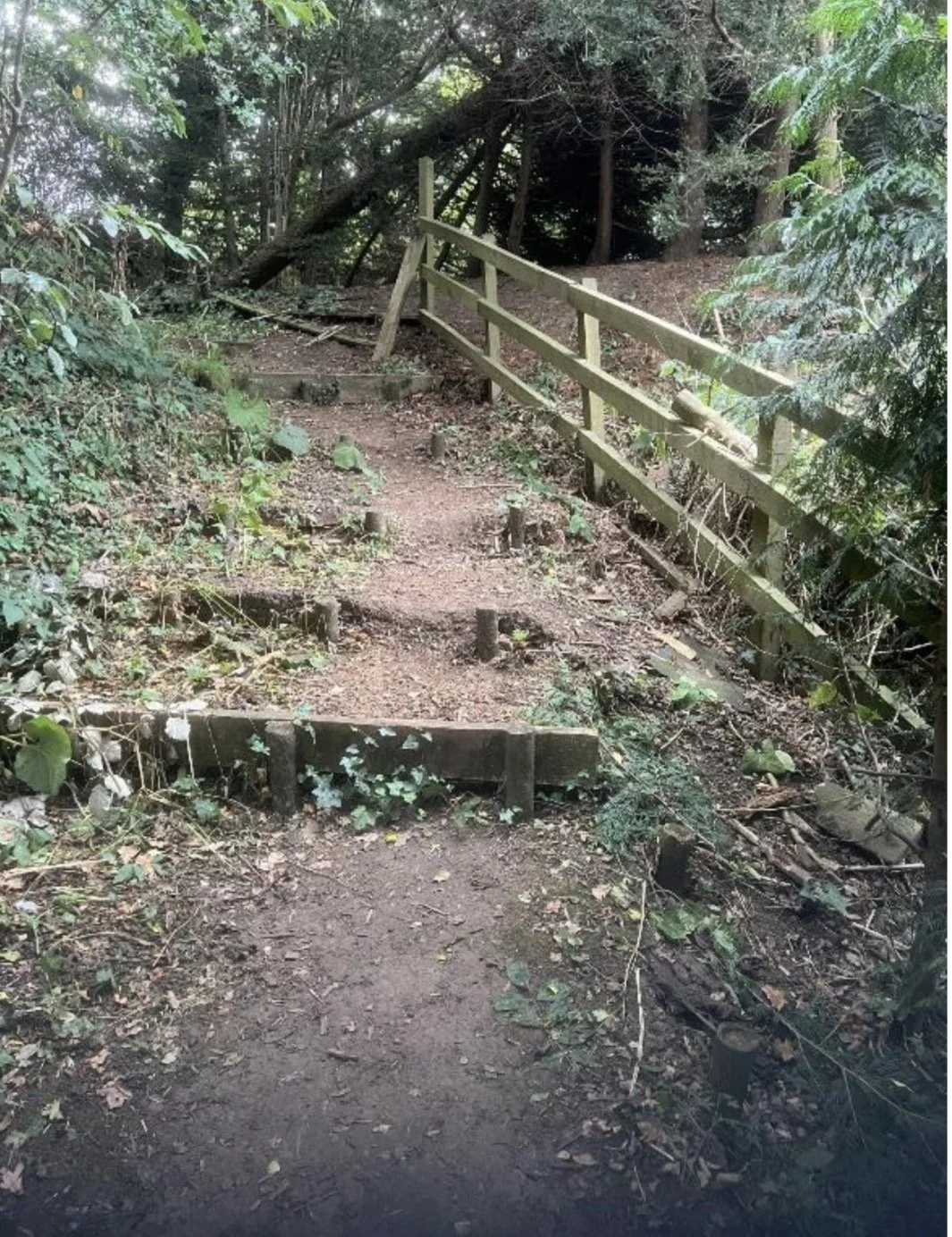
Fence repair at Worsall Road entrance
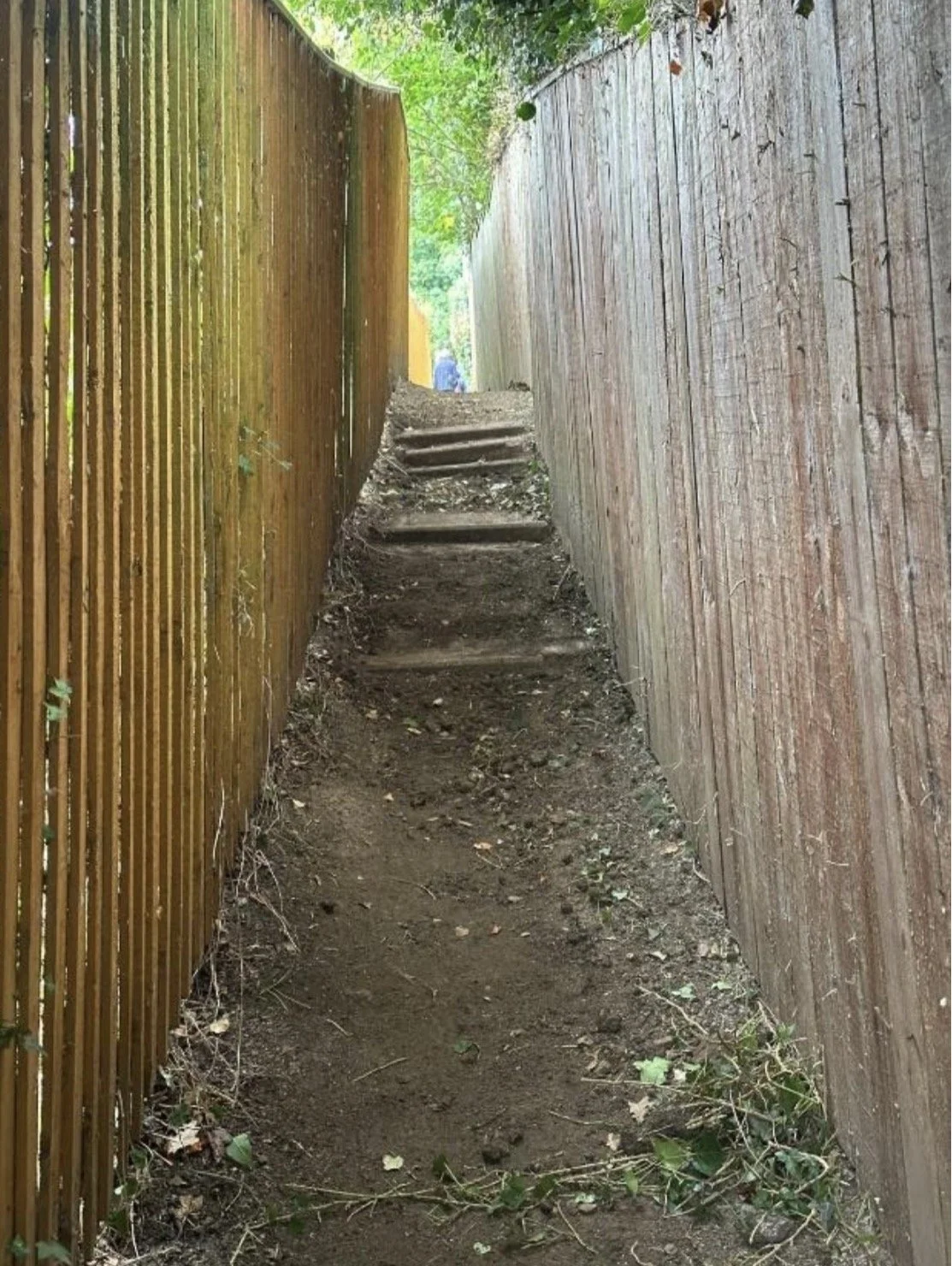
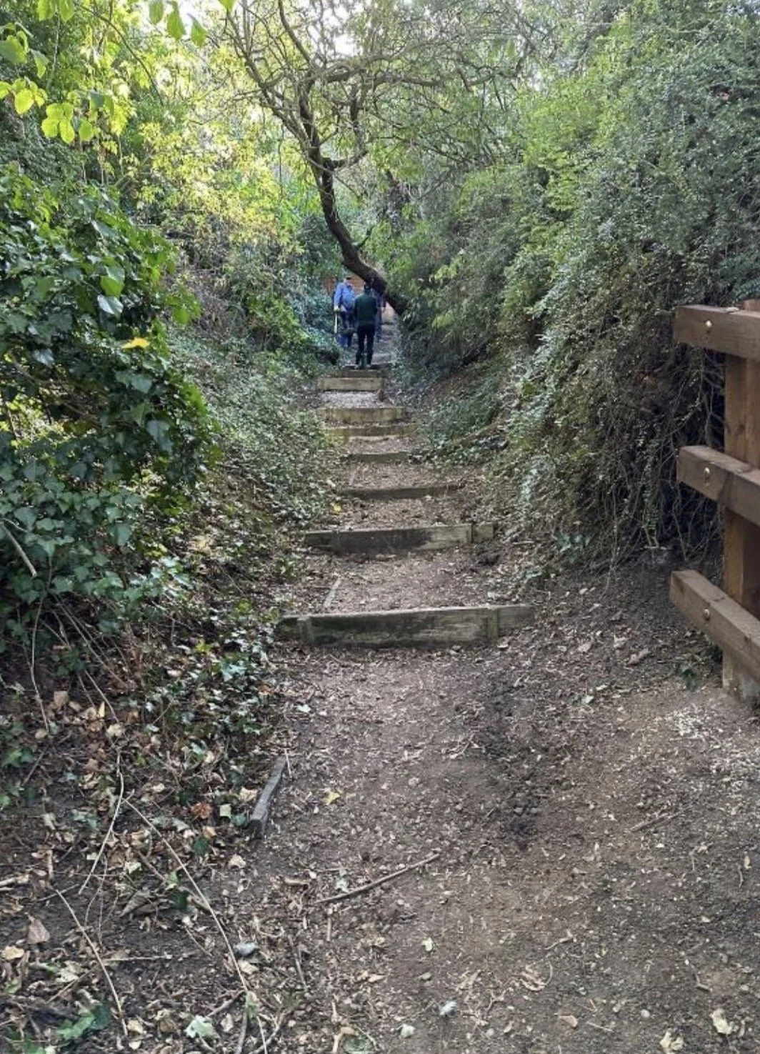
Step repairs at Worsall Road entrance
Current Status and Next Actions: November 2026
We have now completed our work on this section for the current season.
From our perspective, the path is now safe to traverse for a fit person without mobility issues and wearing suitable footwear.
It is not, and never will be, suitable for pushchairs or wheelchairs or those with mobility problems. It is a woodland walk, similar to one could find in a national park.
The path is still regarded as closed by Stockton Borough Council and we will liaise with them to determine a possible opening date.
We should not actively encourage the use of the path until we have SBC’s approval.
We propose that we monitor the position over the winter season and hope that our work remains in place after severe weather and floods.
SBC’s main concern is the danger of landslip on certain sections, particularly adjacent to Rudds Bank Bridge 2.
All being well we would hope for a re-opening in Spring 2027.
THANKS
Thanks are of course due to the volunteer members of The Friends of True Lovers Walk who actively participated, and freely gave their time, expertise and sweat to the project - what a great team you are!!
And to the Lottery Fund which financed our materials.
Maps and references